A vision towards sustainable recovery and equitable growth
Overview
In line with the efforts in Jordan to drive economic transformation and application of international quality standards, Madaba municipality developed a vision towards achieving equitable growth and sustainability. An integral part of this vision is the digital transformation of municipal services.

Background
Digital transformation requires a committed leadership, the allocation of the necessary resources and expertise as well as the long-term cooperation between the different stakeholders. Accordingly, Greater Madaba Municipality established the GIS Unit in 2015, which is a specialized unit that digitalises analogue copies of geographical data and utilizes geographic information system to build a database of street addressing, landmarks, and built-up urban elements.
Objectives
Digitalisation of municipal services in Madaba aimed at simplifying processes by reducing bureaucracy and routine in transactions as well as limiting the number of people who need to visit public institutions, which was necessary during the pandemic and lockdown periods. Primary objectives included:
- Linking the municipal database to the e-government program in the areas of revenue collection, such as building licenses, property taxes, and planning revenue fees.
- Issuing organizational site plans electronically: as in the case in Greater Amman Municipality, the GIS unit enabled providing this electronic service to citizens.
- Launching an urban explorer for Greater Madaba Municipality: the GIS Unit aspires to launch an urban explorer for Greater Madaba Municipality focusing on touristic sites. Citizens and visitors of the city will benefit from this service that ultimately contributes to promoting Madaba touristically.
- Connecting the municipal departments, districts and regions: the comprehensive electronic system connects municipal departments, districts and regions, thus facilitating swift, sound and flexible decision making.

Activities
1- Street addressing:
Madaba municipality has designed and implemented a complete street addressing system assigning a unique alpha-numeric identifier to each building, construction, street and other built-up elements. In addition, the municipality has completed the street addressing by installing signs on buildings and intersections holding the numeric identifier of each location. This project resulted also in developing statistical tables on the buildings’ typology and their licenses, in order to facilitate the identification of the obligations incurred as taxes for the municipality.
Most importantly during the pandemic’s lockdowns, the digital street addressing facilitated the task of emergency workers such as workers in civil defense, medical services, postal services, water, telephone and social services. One of the most important measures that the GIS Unit worked on during the Corona crisis, was the development of scenarios to seal off residential neighborhoods or building blocks during lockdown. The Unit issued maps based on several planning scenarios, in coordination with the competent authorities, including the Center for Security and Crisis Management.
2- Digitalisation of organizational plans:
In cooperation with the Ministry of Local Administration, analogue plans and diagrams were digitalised to facilitate response to citizens’ inquiries about land plots and their regulatory uses, and to clarify their legal provisions.
3- Creating municipal introductory maps:
Introductory maps of Greater Madaba Municipality and Madaba Governorate were issued and distributed to all relevant stakeholders. In total, 38 maps of Greater Madaba Municipality and its five regions were created.
4- Fleet tracking using GPS during collection and transportation of municipal solid waste:
To increase efficiency and reduce fuel consumption by the municipal fleet, tracking of the municipality’s vehicles during waste collection using GPS was implemented. This activity resulted in using the shortest paths, which in turn reduced fuel consumption and its incurring costs. Other activities to promote energy efficiency practices were implemented by the municipality including the installation of smart LED street lighting and recycling of plastic and cardboards. Furthermore, GPS tracking devices for all municipal vehicles were installed.
5- Touristic Map Project:
The Municipality is currently working on preparing a guiding digital touristic map to serve the tourists coming to Madaba for different itineraries, including religious, cultural, heritage, curative natural and environmental, transit, as well as adventure and recreational tourism.
6- Maps Application:
Despite completing the street addressing project, it is not possible to get proper directions due to the unavailability of a navigation tool/app. Therefore, the municipality has formulated a proposal with Connective Cities to develop a web-based application with an interactive map that utilizes a geo-server and a geo-database.
Effects
Utilising digital tools including GIS improved the quality and effectiveness of decision-making in Madaba municipality. Data flow and coordination between municipal departments were particularly improved through the GIS implementation strategy. Nevertheless, a complete digital transformation requires an up-to-date and comprehensive geographic database. To enhance the use of geographic information system, Madaba municipality and their GIS department focus their efforts on developing responsive applications to meet users and citizen’s needs.

Conclusions
Digitalization of municipal services in Madaba municipality improved service delivery, resulted in cost savings, generated return on investment, and improved citizen engagement. This ultimately paves the way towards achieving Madaba’s goals of sustainable recovery from the pandemic and achieving equitable growth.
Images

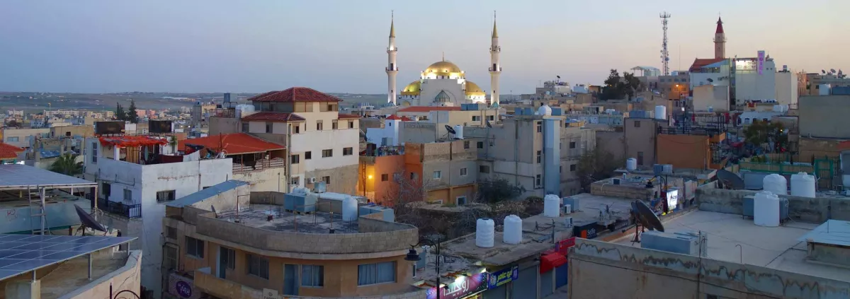
PANORAMIC VIEW OF MADABA IN THE EVENING SUN WITH ITS CENTRAL MOSQUE | © TOMAS PTAK, DREAMSTIME.COM

STREET SCENE AND ARCHITECTURE IN MADABA | © SIEMPREVERDE22, DREAMSTIME.COM

INSTALLATION OF POSTS WITH STREET NAMES | © MUNICIPALITY OF MADABA

MADABA CITY CENTRE BY NIGHT | © ROB ATHERTON, DREAMSTIME.COM

MUNICIPAL STAFF AND USAID REPRESENTATIVES | © MUNICIPALITY OF MADABA

ELECTRONIC ROAD MAP OF THE GIS UNIT | © MUNICIPALITY OF MADABA
MS TAGHREED AL FAOURI, HEAD OF THE GIS UNIT | © MUNICIPALITY OF MADABA
AFFIXING A BUILDING HOUSE NUMBER | © MUNICIPALITY OF MADABA

EMPLOYEES OF THE GIS UNIT DURING TRAINING | © MUNICIPALITY OF MADABA
Further information
Video:
The historic town of Madaba, Jordan - the capital of the mosaics
The video describes the millennia-old history of Madaba in Jordan
(In Arabic with English subtitles)
https://youtu.be/JtdIMMrg6Ag
Contact
Ms. Taghreed al Faouri
Head of GIS unit- Madaba municipality
taghreed.alfouri(at)gmail.com
Mohamad Abu Gaoud
Head of local development unit- Madaba municipality
m_abu_gaoud(at)yahoo.com